Friday, August 8, 2008

Floor Plan


A floor plan is a architectural map drawn to scale to show the relationships between rooms, spaces, and other physical features at one level of a structure. Dimensions are usually drawn between the walls to specify room sizes and wall lengths. Floor plans will also include details of fixtures like sinks, water heaters, furnaces, etc. Floor plans will include notes to specify finishes, construction methods, or symbols for electrical items.
http://www.oaksriverside.com/homepage.php

Terminal Area Chart

Terminal area charts are used in US and Canadian aviation. These are aeronautical charts used for navigation under Visual Flight Rules that show areas surrounding major airports. These charts depict topographic features and other information of interest to aviators flying visually, including major landmarks, terrain elevations, visual navigation routes, ground-based navigation aids, airports, rivers, cities, and airspace boundaries.

http://www.megascenery.com/vol3-us-full-V2.htm

Nautical Chart

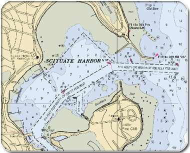
Nautical charts map maritime areas and surrounding coastal regions. Most nautical charts like the one above show depths of water and heights of land, seabed features, and navigational hazards. Some charts also show tides, currents, harbours, buildings, and bridges.


Thursday, August 7, 2008

Tectonic Map


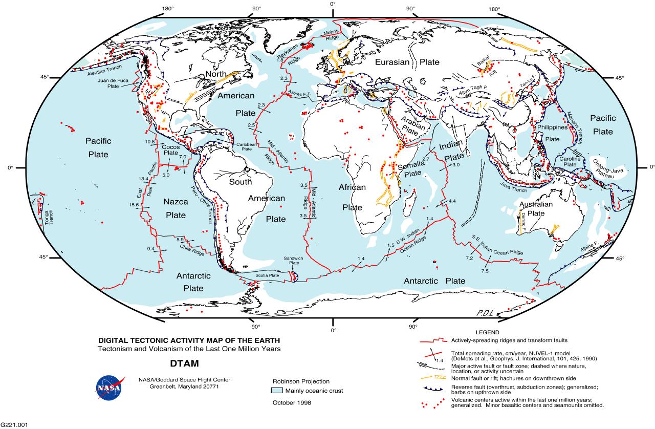
A tectonic map is a representation of structural elements related to the tectonic history of the upper crust of a planetary body. The different structural areas and their separate elements such as faults and folds are shown by various symbols; when combined with a geologic map, data regarding the age and type of rocks comprising the structural elements are given, along with their development over time.

Dymaxion Map


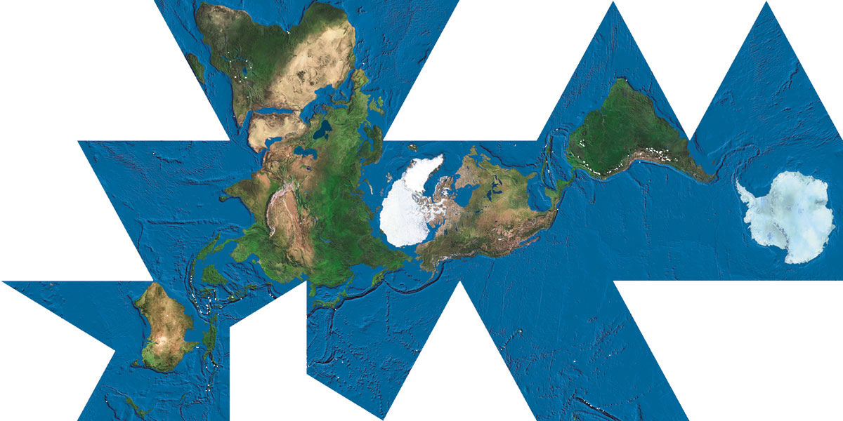
The Dymaxion map is a map projection onto the surface of a polyhedron which can be unfolded in many ways and flattened into a two-dimensional map. This map retains most of the relative proportional integrity of the globe map.


Pictoral Map


A pictorial map depicts a given territory with a more artistic style. The cartography can be a sophisticated 3-D perspective landscape or a simple map graphic that includes illustrations of buildings, people and animals.

Geologic Map


A geologic map shows geological features. The stratigraphic contour lines are drawn on the surface of a selected deep stratum so that they can show the topographic trends of the strata under the ground.

Albedo Map


An albedo map shows the measured difference in surface reflectivity from the surface of celestial body. The albedo of an object is the extent to which it diffusely reflects light from the sun.

Orienteering Map


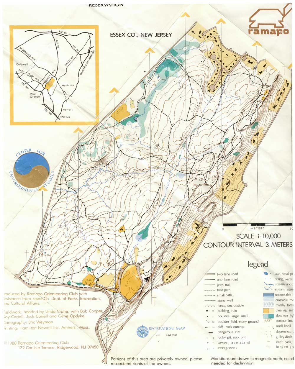
An orienteering map combines both general and thematic elements, designed for a very specific user group. Most of the characteristics of orienteering maps are related to those found on hiking and general use maps produced by the government.

Population Profile


A population profile is a chart showing the number of people as a function of their ages. The profile above charts three different time periods and was made by the US Census Bureau.

Wind Rose


A wind rose gives a view of how wind speed and direction are typically distributed at a particular location. Presented in a circular format, the wind rose shows the frequency of winds blowing from particular directions.


http://www.srs.gov/general/pubs/ERsum/data01.html

Climograph


A climograph is a graphical depiction of monthly precipitation and temperature conditions. Precipitation is shown by a bar on a graph while a line graph depicts temperature.

Scatterplot


A scatterplot displays values for two variables for a set of data. The data is displayed as a collection of points, each having the value of one variable determining the position on the horizontal axis and the value of the other variable determining the position on the vertical axis.

http://psyc.queensu.ca/~frostlab/sun98.html

Triangular Plot


A triangle plot is a graph of 3 variables which sum to a constant. It graphically depicts the ratios of the three variables as positions in an equilateral triangle.

Parallel Coordinate Plot


A parallel coordinates plot is a graphical data analysis technique for plotting multi-variable data. A set of parallel axes are drawn for each variable. Then a given row of data is represented by drawing a line that connects the value of that row on each corresponding axis.

http://www.palgrave-journals.com/ivs/journal/v6/n2/fig_tab/9500151f22.html

Stem and Leaf Plot


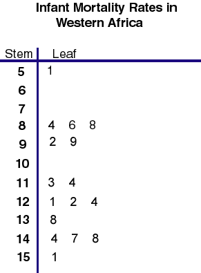
Stem and leaf plots displays data to show its shape and distribution. The data is arranged by place value. The digits in the largest place is referred to as the stem and the digits in the smallest place are referred to as the leaf (leaves).

Star Plots


A star plot is a method of displaying multi variable data. Each star represents a single observation. The star plots above show the crime rates in different US cities.

Correlation Matrix

A correlation matrix is a graphical representation of the correlation between two numeric variables. The matrix above shows the correlation between excess tax returns and the S&P 500 through different investment companies.

DOQQ


A Digital Orthophoto Quarter Quadrangle (DOQQ) is a digital raster image of an aerial photo mapped by the USGS. In a DOQQ, image displacement caused by terrain relief and camera tilt has been removed. This is a DOQQ of a portion of Washington D.C.

DLG


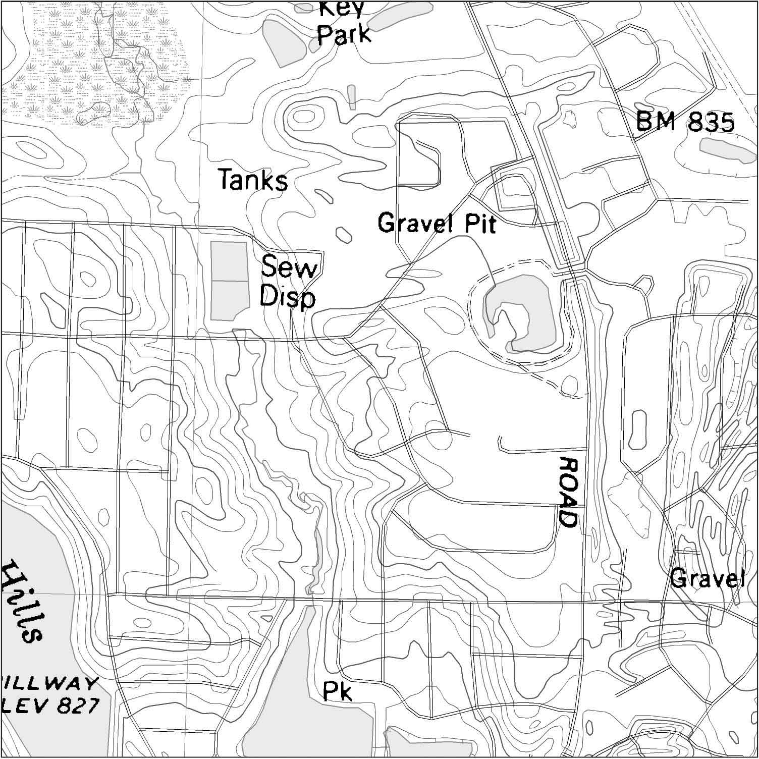
Digital Line Graphs (DLGs) are digital vector representations of cartographic information derived from USGS maps and related sources. This DLG includes raster text.